 A Nation Must Think Before it Acts
Targeting the Russian Rear Zone in a Hypothetical Baltic War
A Nation Must Think Before it Acts
Targeting the Russian Rear Zone in a Hypothetical Baltic War

A nation must think before it acts.

Targeting the Russian Rear Zone in a Hypothetical Baltic War
If Russia were ever to bring war to the Baltic, certainly the Baltic States themselves would not permit war to remain confined to their lands alone. Such has been a repeated message from the Baltic States, Estonia being especially vocal on this point. Expanding the hypothetical ground warfare into Russia would not necessarily solve the strategic problems inherent in Baltic defense; rather, it would simply alter them. Strikes by air power or ground-based missile forces, however, are different and altogether much more sensible operational actions regardless of the ground defense posture.
In the 1980s, NATO developed a defensive doctrine called Follow-on Forces Attack (FOFA), which faced a problem fundamentally similar to that faced by Baltic and NATO defense planners today: how to stop—or at least meaningfully hinder—a larger attacking Russian force. An essential part of FOFA was striking the infrastructure behind the front that enabled enemy reinforcements to move up to the front, thereby limiting the power and momentum of any initial Soviet attack. Although FOFA as such is no longer utilized, its core principles remain reflected in Western military doctrine, with the general division of the enemy into three stylized, geographically defined zones: front or close, rear, and deep. Front or close refers to the broad zone of direct contact between armed forces; targets are most often military, although infrastructure targets matter too. Rear is the band of territory which is directly pertinent to the sustainment of the close battle, of drawing in new manpower or materiel from the deep and channeling it to the front. Here, infrastructure targets are as important, if not more so, than military targets. Deep is behind the rear and has no necessary furthest edge, instead being potentially the entirety of the enemy territory, even in as large a country as Russia. In the deep, targets are no longer necessarily military or even infrastructural per se, although they can be, but are instead often pertinent to the enemy’s sources of economic or financial power, their civilian morale, and so on.
This article, therefore, asks: what potential infrastructure targets are there in the band of Russian (and perhaps Belarusian) territory which would constitute their rear in a hypothetical invasion of the Baltic States? For convenience, this zone will be considered approximately 50 kilometers (about 30 miles) from the border. There are two caveats to this analysis. First, the focus here is on infrastructure used for ground invasion, rather than Russian air or sea power. Second, even with this limitation, the answer cannot possibly hope to be comprehensive, especially when evaluation relies on open-source satellite imagery from Google Maps, but it is nonetheless hopefully indicative of the available opportunities to disrupt Russian operational plans.
Starting in the north, the first potential axis of Russian attack is along the E20 highway from St Petersburg to Tallinn, crossing the Narva River. The only bridge across the Narva itself is at Narva, but in the Russian rear there are multiple road and rail bridges across Luga River: at Ust-Luga (one road); at or around Kingisepp (two road and one rail); and at Porech’e (one road). Another bridge along the Luga falls outside the self-imposed 50km limit at Bol’shoi Sabsk. A handful of other bridges across other rivers in the region would be nice targets of opportunity as well. The destruction of these bridges would delay and complicate the sustainment of any Russian effort on the Narva River.
The next potential axis of Russian attack is from Pskov into southern Estonia, from where it may turn north toward Tartu and Tallinn or continue west-southwest toward Riga. Pskov itself would be a major logistical hub for any Russian invasion, with three road bridges and one rail bridge across the Velikaya River. The destruction of these bridges would for a time seriously compromise Russia’s ability to sustain operations out of or through Pskov. A handful of small rivers crisscross the terrain between Pskov and the Estonian and Latvian borders, with at least a dozen small road and rail bridges offering further targets of opportunity to complicate Russian operations even in that smaller area.
Pskov, as a major logistical hub, could in principle also be used to support an attack along the A13 highway toward Rēzekne in eastern Latvia. Many other worthwhile targets populate this axis of potential operations. The major southbound road out of Pskov (the E95) is on the east bank of the Velikaya. A tributary, the Cherykoha River, flows into the Velikaya from the east, the E95 crossing it on quite a major road bridge, alongside a rail bridge. South of Pskov, the next (road) bridge to cross the Velikaya appears to be over 40km away near Shabany, with another road and a rail bridge a bit further on at Ostrov. South of Ostrov is a number of smaller road and rail bridges. An element of history comes into play regarding the rail line from Pskov, through Ostrov, to Rēzekne. The Russian city of Pytalovo was once Abrene, a Latvian city, arbitrarily annexed by the Russian SFSR in 1944, largely because it was a major rail hub which the Russians wanted in their direct possession. In Latvian memory, Abrene is the missing county, unjustly torn from the homeland, but Latvia makes no territorial claims on Russia nor does it even informally want the county back—the only Latvians who still populate the city and its environs are in cemeteries. Yet, because of the annexation, the rail line from Pskov to Rēzekne runs quite close to the 1944-revised Latvian border, at times barely even 50 meters from it. This raises innumerable opportunities for sabotage of the railway by Latvian and other NATO special forces, and would require the Russians to commit substantial resources to fully secure it. It is possible that the railway may be deemed too vulnerable to play a substantial role in supporting an initial Russian invasion.
The next axis of advance, along the E22 highway from Velikiye Luki to Rēzekne, offers comparatively few opportunities for infrastructural disruption. There are a handful of road and rail bridges across the small Reka Issa, which are sufficiently close to the border that their destruction early enough may well impede the actual first echelon of a hypothetical invasion and not merely sustainment or follow-on forces. After all, up until the actual start of the full-scale Russian invasion of Ukraine on February 24, 2022, participating Russian forces were generally deployed 20 or even more kilometers from the border. Even after the first attackers crossed the border, key infrastructural chokepoints like bridges would still have been in use for hours to convey all the deployed Russian forces forward.
The next axes of plausible Russian advance are out of Belarus. Russian forces from northern Belarus could advance toward Daugavpils either north of the Daugava River along the A6 highway or south of it along the P68. The Daugava therefore splits this axis into two semi-detached halves; east of Daugavpils itself there’s only one road bridge spanning the river in Latvia at Krāslava and the next two are about 20 and 50 kilometers downstream from the Latvian-Belarusian border at Uzmeny and Dzisna, respectively, with another four bridges (three road, one rail) cross in Polatsk and its environs another 30 or more kilometers further. The Daugava, especially with some of these bridges destroyed, could substantially impede lateral Russian movement across the breadth of this axis of advance and expose Russian forces to a certain degree of defeat or even destruction in detail. This axis otherwise appears to offer relatively little opportunity for impediment, aside from a couple of road bridges east of Braslaw on or near the road which continues in Belarus from the P68.
The Lithuanian border with Belarus is long and open. Along the northern stretch, Belarus is broken up by lakes rather than by substantial rivers. Those smaller rivers that cut through the terrain appear to do so generally perpendicularly to the border, resulting in a relatively limited set of bridges (such as those across the Neris River by either Smarhon or Smolzavod) whose destruction would probably affect lateral movement across the rear rather than through the rear to the front itself. Closer to the axes of potential advance toward Vilnius, a handful of near-border cities do have a clutch of potentially crucial bridges: Astravets and its surroundings are home to at least six road bridges (and even more, looking further east) as well as a rail bridge (albeit on just an isolated spur line); Ashmany similarly has four or five road bridges; and Lida and environs also has at least six road bridges of varying degrees of potential importance.
The final axes of advance are out of Kaliningrad into southern and western Lithuania. The whole territory of Kaliningrad is within the range of air and missile strikes from both Lithuania and Poland. It is also crisscrossed with various rivers, resulting in perhaps dozens of bridges whose destruction could truly impede the operation of Russian armed forces throughout the territory. However, there is also a complication, given NATO’s publicly professed certainty that it would invade and occupy Kaliningrad in the case of war with Russia. The destruction of the same bridges that would impede Russian forces would also impede NATO reinforcements from crossing Kaliningrad to reach the Baltic States. The conquest of Kaliningrad by NATO forces could widen the reinforcement corridor. It may be judged more advantageous to leave as many of Kaliningrad oblast’s bridges intact as possible, accepting early war risk from more mobile Russian forces in the oblast to increase the flow of NATO reinforcements through it later.
Hitting the identified areas and other infrastructure in the Russian rear will not solve the military problems of defending against potential Russian aggression. Damaged or destroyed bridges would eventually be restored, or temporary new crossing points would be created to bypass the damage. Repairing infrastructure and recovering from damage themselves both take time and could also be interdicted. Warfare is more than mere targeting, but good targeting can ease the rest of warfare. The ultimate effect would be to weaken Russian military pressure on the front for a period, allowing prepositioned Baltic defense forces to hold out longer and buying more time for NATO reinforcements to arrive. Though not a war-winning move by itself, such an infrastructure-targeting campaign would nonetheless ease the military challenges inherent in any defense of the Baltic. When Baltic generals baldly discuss bringing the war to Russia in case of invasion, they must certainly be thinking, at least in part, about bridges such as these.
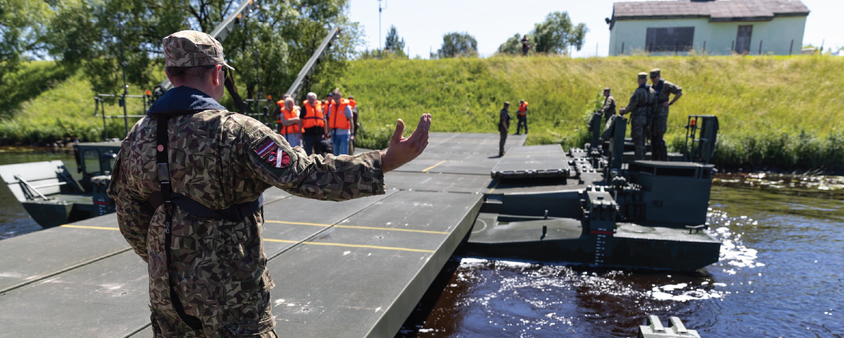
Image: A 2025 demonstration of an M3 amphibious system allowing for heavy machinery to cross rivers without a bridge (Facebook | Aizsardzības ministrija)
